I dusted off the campaign cartographer this weekend while working on some maps for Thule and the Black City; I rediscovered all these old campaign maps, plucked from the wreckage of abandoned campaigns destroyed by Gamer ADD. Anyone else use CC3 for their maps? I was never great with it, but a B&W map shouldn't be too hard - I think I'm going to do the black & white island maps both in Hexographer and CC3 and see which approach I like best (they'll end up with hex overlays either way). In the meantime, here are the forgotten maps of yesteryear:
Greek Colonies
At one point, I thought it would be fun to run something in the ancient world, based around Greek colonists to eastern Spain. Here's the map of Spain, a map of Greece, and then Europe (all done in Campaign Cartographer). I seem to remember there were dwarves in the Pyrenees, and had a dwarven monastery discovered by the Greek colonists. Celtic indigents were bad guys. I don't remember exactly what "Pillage" was about on the Achea map, but I remember my son (who was probably 6 or 7 at the time) wanted me to use it as a city name - I think it was meant to have a Necromancer king and a bunch of undead. I'm laughing that I used Roman names on a Greek map of Europe!
 |
| Tarraco, Greek Colony in Iberia |
 |
| Achea, with the City-State of Pillage |
 |
| Continental map for the Greek campaign |
Forgotten Realms
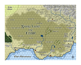
These two are from some starts/stops in the Forgotten Realms when we were still fooling around with 4E just before the old school return and Gothic Greyhawk - one is from the Luruar area, the other is Thar in the Moonsea region.
 |
| The Moonsea |
 |
| Luraur |
Nentir Vale
These must have been from the beginning of the 4E time period - they are two versions of the same smooshed Europe, with names lifted from Hyboria. I can see where I placed the Nentir Vale near the top of the map, assuredly marking these as early 4E era maps.


I wish I had half the skills of making maps on the computer that you have. I can never seem to make my maps look quite right.
ReplyDeleteThe REH style of taking pseudo-archaic not quite recognizable cultures and placing them on a real-world inspired map is pretty cool. I much prefer it to fantasy settings which seem to be poorly disguised copies of various medieval cultures. I remember David Eddings' books really annoyed me in that regard: here are the romans renamed, here are the vikings renamed, etc.
ReplyDeleteWord verification for that last post was "hinverea". Great name for a realm or stronghold.
ReplyDeleteGreat maps :D Question for you though - what symbol set did you use for the mountains on the Tarraco, Moonsea, and Luraur maps? Or did you draw them yourself?
ReplyDeleteThat's a great question - Profantasy has these 'cartographer annuals' where the give out a monthly map style pack with all the drawing tools and symbols - that style is "Pete Fenlon", from one of the early annuals, mimicking the style used on the amazing maps from the old Middle Earth ICE supplements from the 80's.
ReplyDeleteIt's really an excellent style.
Damn - I missed that one I guess. Well, time to go symbol hunting. Ty!
ReplyDelete